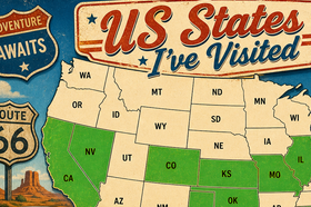
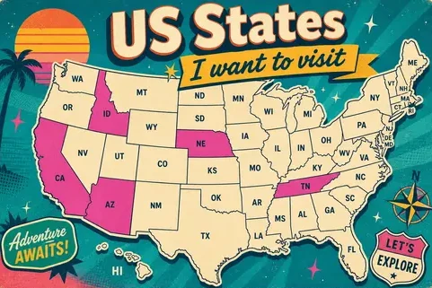
Visited States Map
This interactive visited states map builder lets you create a customizable map to track your US travel history with ease. Simply mark the states you have previously visited and watch your personalized map come to life. In just a few clicks, you can build a beautiful custom map that highlights your journeys across the United States. Share your interactive visited states map with your community and showcase your travel experiences in a clear and engaging way.
Advertisement
Questions fréquemment posées
- How do I create a map of US states I have visited?
- Creating your visited states map is instant, just click any state directly on the interactive map, or tick its name in the checklist below. Each state lights up as you select it, giving you a live, personalized map of US states visited. No sign-up or software is required. You can also create interactive US map selections by sharing the URL with a friend so they can build their own version.
- How to track states I've visited and see my total?
- Enable the Show Stats toggle in the Settings panel to see a running count of how many states you've been to and what percentage of the country that represents. The states visited map updates in real time, making it the perfect states travel tracker for road-trippers keeping score across America.
- How do I save my customized visited states map?
- No account is needed. Bookmark or copy the link to return to your exact personalized map at any time. The URL is your save file for your travel history map, so you can always pick up where you left off.
- How do I share my interactive map of US states visited?
- Scroll to the "Share your map" section below the checklist. Copy the unique link or click one of the social buttons to post your states visited map directly to Facebook, X, Pinterest, or Reddit. Anyone with the link can instantly view your interactive US travel map, no login required on their end.
- Can I embed the interactive states map on my website or blog?
- Yes! Scroll to the "Embedding the map" section, copy the generated HTML snippet, and paste it into any webpage. This interactive map tool creates a fully responsive iframe that carries your exact color settings and state selections, so your readers see your exact custom map.
- Can I customize the states map colors?
- Absolutely. Our US states map builder includes a Settings panel where you can pick individual colors for visited states, unvisited states, the hover highlight, and state borders. Every color change is reflected immediately and saved in the shareable URL, making it a true custom map builder for your personal style.
- What is this US travel map tool and is it free?
- This is a free map maker tool built for US travelers who want a clear visual of where they've been across America. Use it as a travel history map, a bucket-list tracker, or just a fun way to show friends your journey. The interactive states map requires no installation, open the page and start building your map of where you've been in the United States.